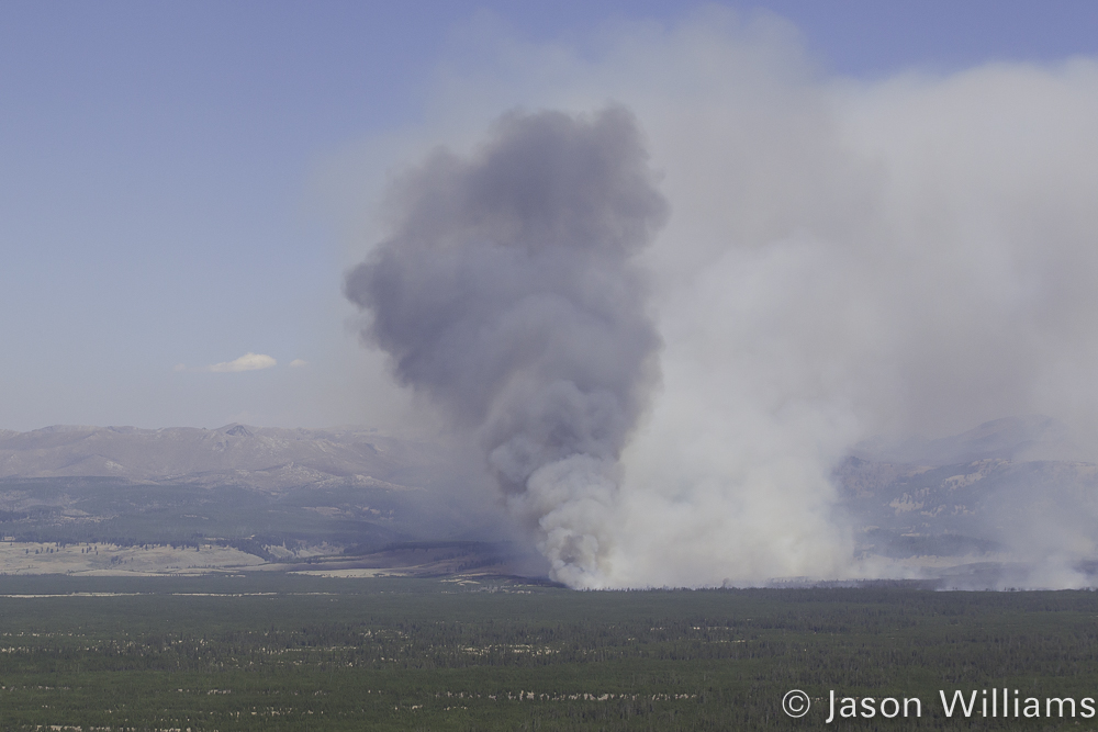
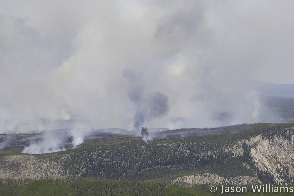
The Maple fire, currently 22,448 acres, grew an additional 6,233 acres yesterday. An infrared mapping flight was conducted last night and the majority of the new growth was on the northern flanks of the fire. The western edge of the fire showed slight growth, mostly due to the fire backing into the wind. The Maple fire remains 4 miles from the West Yellowstone Entrance Station, and 2.8 miles from Madison Junction. It continues to back down the slope near the 7-mile bridge and is one-tenth of a mile from the roadway. It has not crossed the West Entrance road, and firefighters do not anticipate it crossing the road. Contingency plans have been developed, should the fire move westward towards West Yellowstone, and firefighters plan on holding it to the east of the Madison River.
Yellowstone National Park – August 22, 2016.
The West Entrance road remains open. Should smoke or fire activity increase; pilot cars may be implemented to safely escort vehicles through the area.
The National Weather Service has issued a red flag warning for Yellowstone National Park and the surrounding area beginning at noon today. Strong, gusty SW winds (25-30 mph) are anticipated, coupled with lower humidity (8-13%) and warmer temperatures (79-84) will likely increase fire activity and behavior, especially on the east and northeast edges of the Maple fire. The same weather will influence the Buffalo and Fawn fires, and both will show increased smoke and fire activity.
Yesterday the Buffalo fire showed increased fire activity early in the day, until smoke from the Maple fire shaded it, slowing down fire growth. The Fawn fire continues to show growth as fuels dry out.
The Boundary fire, 192 acres, is 75 percent contained. Firefighters continue securing the fire’s edge and are working deeper into the interior of the fire removing hazard trees as appropriate and safe to do so.
Maple Fire: 22,448 acres Location: 4 miles east of the Park’s west boundary, and 5 miles northeast of the community of West Yellowstone.Started: 8/8/16 lightning-causedClosures – Campsites: WA1 Trails: • The entire Gneiss Creek trail is closed from the Gneiss Creek Trailhead (WK7) to Seven Mile Bridge trailhead (WK8). This includes the Cougar Cabin trail.
Buffalo Fire: 2,279 acresLocation: The Buffalo fire is located approximately 3 miles northeast of Tower Junction and 3 miles south of the park boundary, and is visible from the Lamar Valley.Started: 8/13/16 lightning-causedClosures- Campsites: 2S1, 2S2, 2S3, 2S4, 2S6, 2S7, 2S8 Trails: • Buffalo Fork trail from the trailhead at Slough Creek north to the Park boundary. • The Slough Creek trail is open for day-use and thru travel.
Fawn Fire: 1,496 acres Location: The Fawn fire is located west of Fawn Pass, 11 miles west of Mammoth Hot Springs, 16 miles northeast of West Yellowstone, 13 miles southwest of Gardiner, and 35 miles southeast of Big Sky. Started: 8/4/2016 lightning-causedClosures – Campsites: WB1, WB3, WB4 and WB6 Trails: • Bighorn Pass trail eastbound at the junction of the cut-off trail to the Fawn Pass trail. • Bighorn Pass trail westbound at Bighorn Pass. • Fawn Pass trail eastbound at the junction of the cut-off trail to the Big Horn Pass trail. • Fawn Pass trail westbound at campsite 1F2. • The cut-off trail between Bighorn and Fawn Pass trails is open.